American Sabbatical 024: 9/29/96
Granite Creek
9/30... Granite River.
We shook ourselves awake at dawn in a freezing wind along the Big Sandy. No wonder they
call it the Wind River Range. Even with all our winter clothes
on and our morning porridge and mug-up in hand we were shaking.
Didn’t take us long to saddle-up Festiva and gallop down that
dirt road to the highway.. watching antelopes jumping the barbed-wire
fences as we pulled our plume of dust. No more camping in the
high country, we swore.
| Once we’d thawed ourselves with Festiva heat and road coffee,
we were almost ready to take off a layer or two. By the time we
hit Pinedale the temps were pushing 80, and our spirits were rising,
too. In Pinedale we visited the Mountain Men Museum, yet another
new addition to Wyoming’s tourist attractions. At least the building
and displays were new, and quite attractive. The presentation
was much too text-heavy (I should complain?), and the artifacts
a bit scarce, but it was very professional, informative, and the
staff ready and able to answer any questions. All very low-key.
|
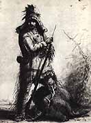
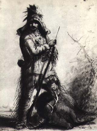
Mountain Man
(Alfred Jacob Miller)
|
We might have given yet another museum a pass.. our ability to
absorb all this local historic juice is getting squeezed thin..
but one of my quests was to find Pierre’s Hole, site of the 1832
fur trade rendezvous. It seemed as if half of the journals I read
last year were by men who were in Pierre’s Hole for that pow-wow.
Wyeth, Bonneville, Carson, Etc., Etc. And I’ve been unable to
locate it on any map. One journalist said that the three Tetons
were in sight there, so we must be close as we approach Jackson
Hole. Well, the Mountain Man docents couldn’t pinpoint it on a
contemporary map, but they could come within a couple of miles,
so we’re homing in.
|
Which leads to a digression about mapping. (We’re getting expert
at digressing on maps.) It is almost impossible to perceive rivers
and mountain ranges on contemporary maps, road maps in particular.
Even the geodesic survey maps don’t read topographically for me,
too many squiggly contour lines that don’t cohere. The maps bound
in with the 19th century travelers’ accounts were river maps,
sometimes showing the mountains and hills. They make sense to
me. In those days the rivers were the roads, of course. Even out
here in the open country where riverside going might not be the
easiest, they guaranteed water (maybe potable) and maybe forage.
Even though our horsepower has changed, those river maps still
show the landscape in a way no modern maps do. This perceptual
shift in how we conceptualize the landscape runs deeper than new
road cuts. Our maps are now about political boundaries, place
names, and the fastest way to get there. The rivers and hills
still define the real estate, only we don’t see them, or think
about them. Is it any wonder our rivers are sick, that there’s
a water crisis, and our ecological consciousness is fragmented?
As we travel, the pennies keep dropping about how this country
is put together. That the Bighorn River rises in the Bighorn Mountains,
for example. Geography isn’t rocket science, but trying to find
topography on a TripleA map might convince you otherwise. A complete
set of North American watershed maps would be a boon for this
quest, and might teach us all how the country is threaded together. |
|
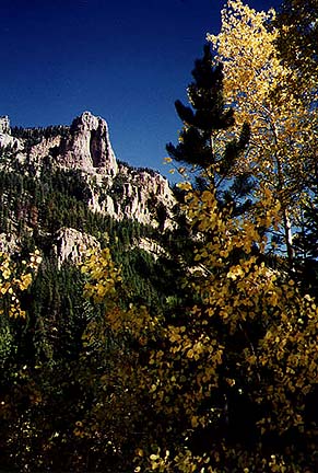
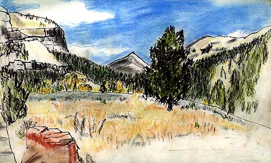
Aspen & Granite
|
The ladies at the Mountain Men Museum were so well informed about
the area, that was asked them about accommodations around Yellowstone,
our next stop. They warned us that motel rates were “around $100”,
and we choked. Our max is $40/night, and we haven’t had to pay
that, yet. But, they said, there was a campground at a hot springs
about halfway to Jackson we might be interested in. As you might
guess, Peggy’s eyes lit up. Up was the keyword. The road to Granite
Hot Spring was 9 miles UP a washboard dirt track, straight UP
the mountains. The site was absolutely spectacular. We cringed
for Festiva as she jolted over the rocky outcrops and shuddered
over the corduroy, but once the bucking was over we were enthralled.
We were all alone at a swimming pool built by the CCC (which makes
it research, right?), with a panoramic view of lofty granite peaks,
and that high altitude sun came slanting down on us. The temperature
of the water was 98 degrees. Just about perfect. We did pas de
deux sunwise in the pool like a pair of synchronous seals in a
geriatric circus. Even the sulfurous air wasn’t excessive. |
| We pulled one another out of the bliss before we’d gotten too
limp to move, and decided that maybe we COULD camp another night.
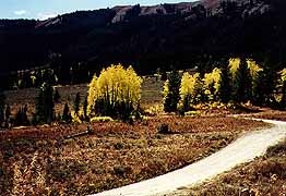
Right there. So we did. Tried to draw mountains.. to capture the
bright yellow aspens and the black spears of lodgepole pines against
the immensity of yellow-orange peaks. Tried to look at Pinnacle
Peak without falling on our backs. Shuffled our feet alongside
the Granite River. Thought about being at the headwaters of the
COLUMBIA watershed way up in the Gros Ventres, and fell asleep
to the roar of Granite Falls. When the howling of coyotes awoke
us at midnight, Peggy said “It really isn’t that cold tonight,
is it?” By daylight we were froze to the bone, AGAIN. |
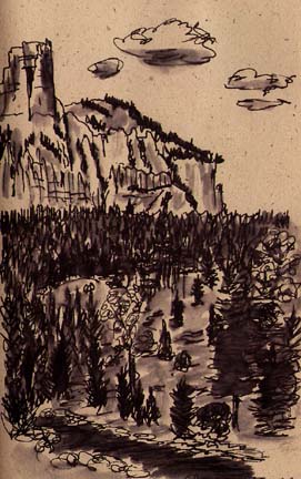
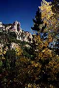
High Granite
(Bryce)
|

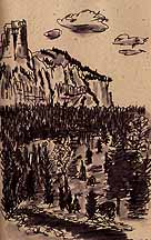
Granite Creek
(Bryce)
(Memo # 24)
Hot Sulphur Springs
|
Sept. 28/29 - Taking the Waters, Wyo.
Who? Nature, CCC, and entrepreneurs
What? hot springs
Where? Jackson, Wyoming, and Thermopolis, Wyoming
When? CCC constructed pool at Jackson in 1930's, Thermopolis bought
from Native Americans and developed as state bath house
How? New Deal project and Wyoming state support
Question: How is Thermopolis, Wyoming, like Baden Baden? |
If you can answer that questions, you know how I have gotten an
incredible treat in the last few days. Mineral hot springs. In
two very different settings indeed.
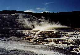
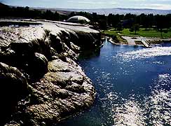
The first hot spring is in Thermopolis, Wyoming, where the white
rock letters on the butte overlooking town boast “World’s Biggest
Hot Spring”. Thermopolis is a typical Western town, wide dusty
main street with a mixture of businesses in a small valley surrounded
by barren hills.. Then you go a half mile down a side street,
across a small bridge, and are in an oasis. Wide lush green lawns
with huge trees form a real park with several low buildings around
it - two motels (perhaps the only ones to advertise hot springs
on site). One had been a hospital for people seeking relief for
their ailments in the waters.
|
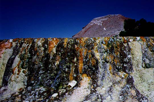
Hot Sulphur
|
View of Thermopolis
|
I had no idea what to expect having heard of isolated pools up
canyons. I certainly didn’t expect to see two water parks with
huge slides and diving boards flanking a “State of Wyoming public
bath”. Well. Public baths in my experience are part of Rome and
certain religions and turn-of-the-century ghettos.
|
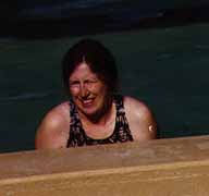
| We went in and a park ranger gave us locker keys, asked us whether
we wanted indoor or outdoor pool and signed us in. She warned
us only to stay in forty-five minutes due to the heat. I change
into a bathing suit and went outside. The outside pool was about
forty feet square and four feet deep. No swimming allowed here.
A variety of people were simply sitting immersed up to their necks
on seats around the pool. The center was shaded by a roof supported
on four pillars. The water was hot and slightly sulfuric to the
smell. And very very soothing. Road fatigue melted away. |
|
|
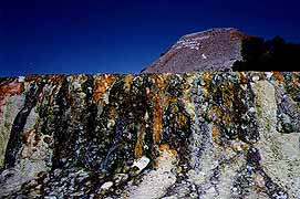
Totally relaxed and redressed we walked around the descending
set of pools that were the original pre-bathhouse site. The mineral
water has colored the rocks in rainbow hues and it is a colorful
scene. We tested the water near its source and it was almost boiling.
They must cool it for the bathers. Apparently the Indians used
the hot springs for health. When they sold them to the government,
it was with one condition. One third of the springs’ use would
be free. We benefited as a result. |
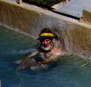
| Two days later I am up to my neck in warm water again. This time
over 8000 feet up on a mountainside near Jackson, Wyoming. This
hot springs is nine miles up a dirt road and another 1/4 mile
by foot to a man-made pool (painted bright blue) on the mountain.
The changing room is a log building. The pool is irregular, perhaps
thirty feet across at its widest. You can swim. So we did, in
water that the thermometer said was 98.6 degrees F. It seemed
incredibly luxurious to be in a warm pool surrounded by mountains
with a brisk breeze blowing. |
High Camp
|
There was an odd historical connection. The second pool had been
constructed during the 1930’s by the CCC. I thought this New Deal
program had created trails and mountain buildings. It must have
seemed odd for young men desperate for jobs to be sent to the
mountains to build a swimming pool!

Granite Creek
(Peggy)