American Sabbatical 023: 9/28/96
South Pass
9/28.. continued
So now where? We were almost to the east gate of Yellowstone Park, but the
road was reportedly closed by icy conditions.. and we wanted to
cross the continental divide on the emigrant trail, which is to
the south. Peggy insisted that we backtrack to join the Oregon
Trail at the North Platte and follow the Sweetwater over South
Pass, knowing that was one of my fancies. And it just happens
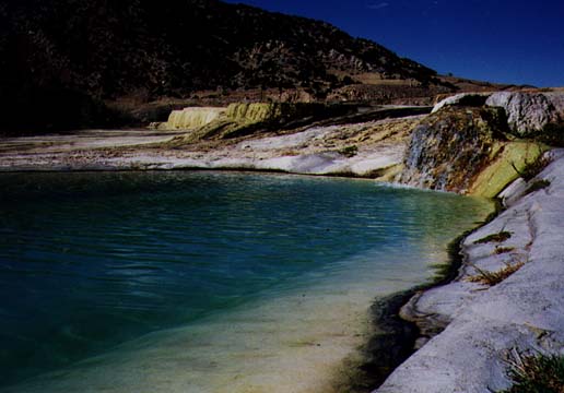
that THE WORLD'S LARGEST MINERAL HOT SPRING is between here and
there. In Themopolis.
| Those of you who know that Peggy has lived without a plumbed bathtub
for the last 12 years, without making a loud plaint.. that she
has accepted the spacial utility of hot showers vs. the therapy
of the bath with only an occasional soft groan.. they can perhaps
imagine her glee today as we rolled through a dramatic Westscape
into Thermopolis. |
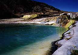
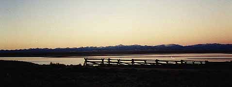
Hot Mineral Springs
|
But can you find the hot spring for the spa? Do you have to ride
the waterslides? Buy taffy and trinkets? As we drove between the
Inns-with-massage, past manicured lawns with tropical umbrellas,
we wondered how much this whim would set us back. We under-estimated
the state of Wyoming. The State Bath-House is FREE. So, among
the sulfurous reeks and steams, under a cloudless sky, we washed
it all away.
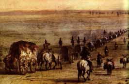
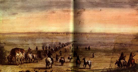
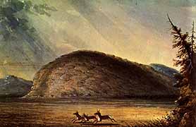
Emigrant Train
(Alfred Jacob Miller)
|
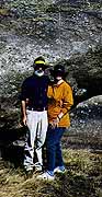
Struck up conversation with a couple at the waters.. actually
in the waters.. he runs wagontrain reenactments for dudes and
filmmakers, and was soaking away the bruises from muleskinning.
After a bit of prodding he began to wax poetic about taking flatlanders
onto a higher plain. He said that the West represents the American
Dream. The quest for individual fulfillment in a new world. He
tries to connect his clients with a Native sense of the land as
they recreate the emigrant experience. Here we were in up to our
necks again with the two cultural currents flowing together. Newcomers
seeking Nativity. Catlin goes to Hollywood. |
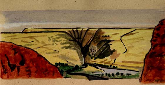
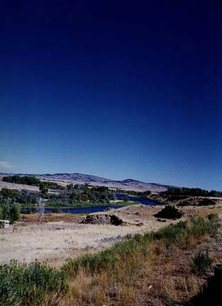
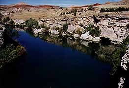
We moved slowly out of the fumes and plunged into the Wind River
gorge. Up stream into a deep cleft through Precambrian granite
and 500 million years of overburden. Thought we’d just sloughed
that off. The sparkling river swirling over gavel bars was full
of fly-fishermen (and women) making their glistening ritual with
wands. Then we climbed up to the Boysen dam and reservoir, and
the panorama of a drowned tableland with the Wind River Range
on the horizon beyond. Another hundred feet up and we were back
on the big empty, with another 100 miles of it to Casper. Just
jackrabbits, antelope, tilting oil rigs, the bronze grasses and
the dusty sage.

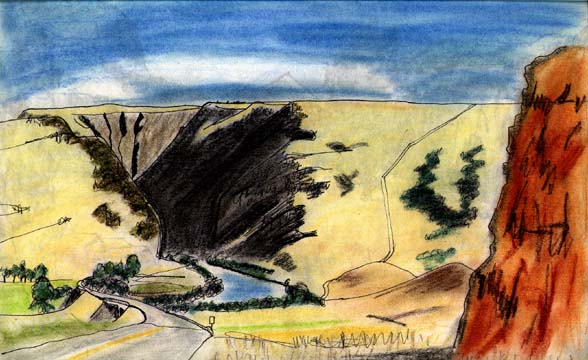
Wind River Gorge (Bryce)
We had hoped to get a sense of the last prairie miles of the emigrant
trains before they rose the shining mountains up out of the plains,
but we’d forgotten that would mean backtracking ourselves. It’s
ok to wax slickly about the sweeping smooths first time around,
but we’ve been up the hill now, and.. And Casper is a different
breed of Wyoming. At least coming in from Thermopolis. The suburbs
are all oil rig supply dumps and rigger bars. The sunset was jabbing
us in the eyes, the traffic was Saturday night rude, and downtown
Casper could have been any cement metropolis. We were back on
the main street of America, to be sure. Anywhereville with MacBurgers.
So we slumped into a Super8 on the banks of the Platte, feeling
like we’d been muleskinning all day. Out of the picturesque and
back on the History Trail.
9/29.. Over the top.
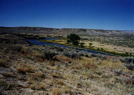
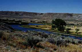
| While Peggy put together her school messages in the early AM, I went for a walk along the banks of the North
Platte River, looking for the footprints of the emigrants. The
Oregon trail ran right below the Super8. Very convenient. We had
made a long day’s swing east and south to pick up the trail, and
I was sniffing for old traces. All I met was a quintet of labs
on their morning run, along with their people, and I got muddy-pawed
and otherwise caressed, as I deserved for playing hound. |
Along the Platte
|
It’s a long slow poke over the Great American Desert, even in
a Festiva at 65. That is, when she’ll do 65. We were slam-to a
hard westerly, hot and dusty. The air had that dessicated texture,
and the scene had that washed out coloring that says West to me.
And Festiva was laboring hard against the hot buffets, while our
local star was searing any exposed flesh. This historical verisimilitude
can go too far.
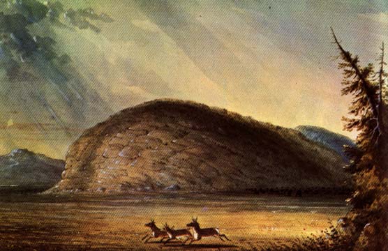
Independence Rock
(Miller)
|
The deadly flatlands began to acquire edges as what looked to
be molten rockpiles rose up alongside the plains. Ahead of us
was one solitary glob which looked especially fresh-laid. As we
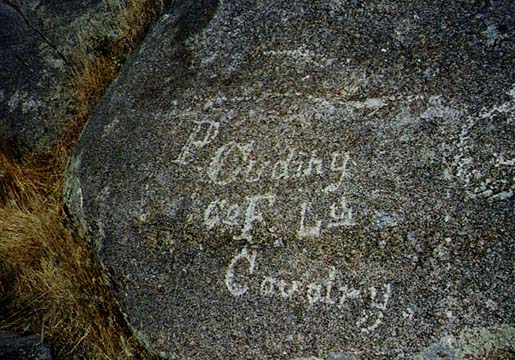
flashed by the sign say “Independence Rock.” Hard U-ey, Festivites.
There it was, America’s monument to graffiti. The place where
those crossing over to a new life would stop and scratch their
Jim Bridger on the gray granite. If you got there by July 4, you
would probably get to Oregon before the passes closed, another
reason to celebrate the Fabulous Fourth: hence Independence Rock.
|
Jim Clyman in his journal of 1844 remarks that he found where
he and Sublette and Fitzpatrick had left their marks in 1824.
We couldn’t find them. But it is amusing to see the wall of this
great glob of rock fenced off so nobody can deface old graffiti.
Who says wickedgood is something new? We joined the historic spirit,
had our nooner by the rock, and traced some old scratchings with
our fingers. Then we used the state of Wyoming’s sparkling roadside
facilities. Something the wagoneers might have liked. When we
commented to a Wyomingite about this courtesy to travelers, and
how you couldn’t find public restrooms in Maine, she observed
that it was probably because the sagebrush is so low.
| It's uphill all the way from where the Platte joins the Sweetwater,
the ultimate tributary of the Mississippi system on the emigrant
trail, and Festiva was dragging her tired feet. We stopped at
every historic pullover (and Wyoming has more pullovers than L.L.
Bean). Devil’s Gap, Split Rock, Gasp For Breath, and Woah-up.
Finally I remembered a mechanic’s advice from Bowdoinham. I disconnected
our pony’s battery, and recycled her brain. Just like a bag of
oats for a tired pony: with new computer settings she fired up
her octanes and charged uphill like.. well like a Festiva with
105,000 miles. Yup. That’s right, we’ve put 6K on the darling,
and we’re only half way up the Oregon Trail. Be kind to the horses. |
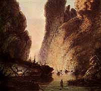
Devil's Gap
(Miller)
|
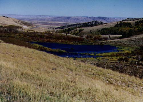
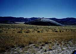
The Sweetwater is just a little sister to the Platte, and she
shrinks into a backyard brook as you climb to 7000 feet. The vegetation
in the valleys we were following changed from cottonwood bottomland
to high plains gully to alpine meadow-and-swamp as we approached
the top of America. There were beaver houses and ponds punctuating
the tumbling stream, aspen and firs tucked into the hillsides.
We’d made an immense long climb to the heights of the continent.
Now we were looking in all directions for signs of the storied
South Pass. The slot that hundreds of thousands of starry-eyed
travelers had passed through on their way to tomorrow. But the
sun still seared, and the long slopes wouldn’t quit.

High Waters
|
When we came to a sign for Atlantic City and South Pass City,
we swung off onto the dirt road, expecting another historic outlook.
But, seven miles along the gradings, we came down a wiggle in
the hills into a company town. The Atlantic City Mine perched
on its hill, and the employees were clustered together in log
cabins, trailers, and small frame houses, all higgle-piggle up
a gully, looking for all the world like a 19th Century mining
town. Log chapel with rickety frame bell tower, the works. |
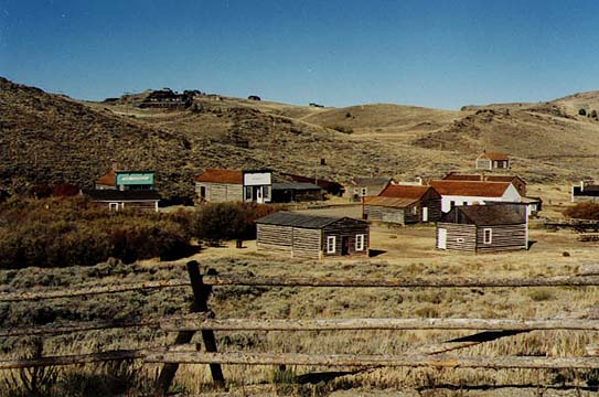
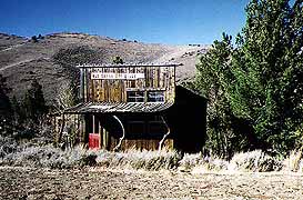
Then two miles farther and you are in South Pass City, a reconstructed
19th Century mining village (without all the junk in the yards).
This gem was totally unmarked in the guides we’ve been using,
in fact it is a new addition to Wyoming’s tourist bait collection.
Just the bare bones of a town, in a bare bones place. But the
feeling of time and place are strong enough to make your head
spin, or maybe it’s the altitude. We did the ritual walkabout.
| Half a mile father west are the graves of two women travelers
who never made it over the watershed (one was the Oregon missionary,
Whitman’s, first wife). We didn’t pause to commiserate. The top
of the hill had to be in sight. And then it was. A great wide
saddle easing over America. The snow-capped Wind River Range standing
to the North (hence South Pass), and the Antelope Hills to the
south. At the sign “Continental Divide” we yelled “YEEHAW, California
here we come!” |

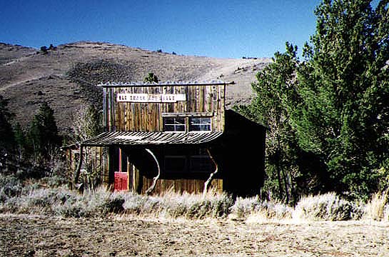
South Pass City
|
Now the sun was squarely in our eyes and we were a couple of beat
emigrants looking for a waterhole. But the downslope is just as
empty and endless as the up. The towns out here are few and unmotelled.
The next likely crossroads was 130 miles away. We started to sag
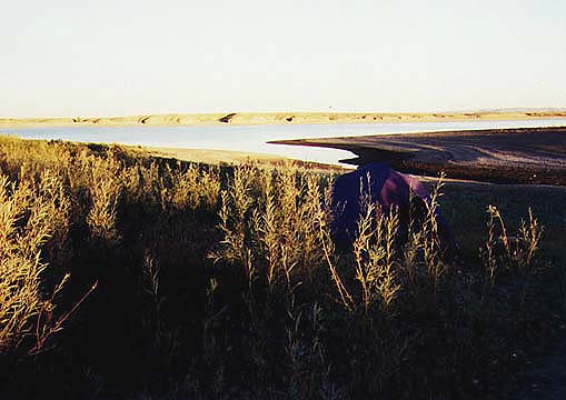
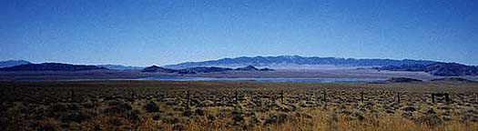
a little. But Seth’s FREE CAMPING book came to the rescue. There,
just 8 miles down a dirt road, was Big Sandy Campground. Big as
in wide open, Sandy as in bare as.. well, bare. But there were
sundown flaming mountains east and west, and we off-loaded Festiva
alongside one of the uppermost tributaries of the Colorado River
(via the Green). Over the hill and far away.
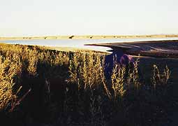
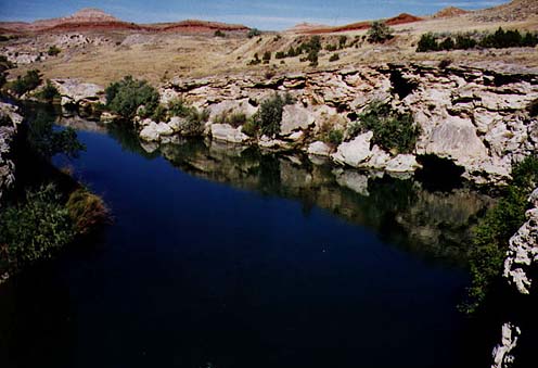
Camping at Big Sandy
|
A couple of hunters from California came around the waterhole
(a reclamation lake) to wash their hands after getting their antelope,
and stopped to brag a little. They said the locals thought them
nuts to drive from California to kill “goats”. I asked if the
early travelers’ reports were true, that antelopes were difficult
to approach, and did they use the old trick of lying on their
back and kicking their feet in the air to lure them in. They laughed,
and said they were hard to get close to, and they did wave a handkerchief
at them to turn them for the kill, but hadn’t tried waving their
feet. Then everything turned purple, and yellow, and green, and
black. The stars came out and we all fell down. |
Yup. After that scorching day it FROZE in the Big Sandy valley,
and we wondered again about our sanity. BUT: so far we have camped
1/3 the time, visited with friends 1/3 the time, and only motelled
1/3 the time.. so we might be able to afford this craziness. In
the night a spookbird visited our encampment and cried his eeriness
into the old moonlight. When I went out, our gibbous neighbor
was whitening the mountains, and the frozen air hung shining over
the sagebrush. I cold-footed it back into the tent.
Sunset at Big Sandy
(Memo #23)
Sept .29/30 - Oregon Trail and South Pass, Wyoming
Who? trailblazers James Bridger and Thomas Fitzpatrick
What? Oregon Trail from Independence, Missouri to Wilamette Valley,
Oregon
Where? up Platte River to Sweetwater River, over South Pass
When? most heavily used 1843-60
How? wagon trains
|
Oregon Trail
|
|
Topics: Oregon Trail, westward movement, US geography, Great American
Desert, South Pass, Independence Rock, emigrants.
Questions: What was it like on the Oregon Trail? How are the High
Plains different from the Low Plains? |
|
All the way west, we’ve tried to stay off major highways. There
is one” major highway” we’ve wanted to use - the Oregon Trail.
We drove to Casper, Wyoming, on the Northern Platte River and
followed the Oregon trail west through South Pass over the Continental
Divide.
Along the Platte
|
The estimates are that 350,000-500,000 people traveled west over
this route mainly in the 1840’s and 1850’s. It was the main overland
route to the west coast before the railroads. Travelers started
from settlements in Missouri, they had to be through the mountain
passes of the Rockies by fall. They traveled in Conestogas wagons
pulled by teams of oxen or horses, hauling all their worldly goods.
We have all our goods for the trip west in the back of a small
car, but we’re not trying to homestead at the end. Over 2000 miles
at ox pace.
|
Why Oregon is a key question? It was a misperception of the geography.
The Plains were seen as useless for farming since only grass and
shrubs grew there. The early settlers called the land between
Mississippi and mountains the Great American Desert. Settlers
were used to eastern woodlands, felling trees to clear fields.
When I saw Iowa I wondered how any settler could pass its beautiful
grassy river valleys by. It seemed ideal farmland; not so central
Wyoming.
High Plains
This is why it’s useful to distinguish the HIGH plains from the
LOW plains. The low plains mean low in elevation and they are
also called the highgrass prairies or the eastern plains. These
really are much “lusher",with rolling grasslands that look like
what we would call “fields” or “pasture”, the grass is thick.
There are many rivers and springs and TREES along the water courses.
Early reports say the original grass in the eastern Plains could
hide a man on horseback! The high plains of central Wyoming, Montana,
the Dakotas ARE desert even though animals survive on the sparse
vegetation.
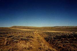
| Central Wyoming really looks like a desert. The main vegetation
is sagebrush in regular scattered clumps (at most waisthigh bushes).
Some grass patches and tiny plants, but most of the land is barren
ground, dirt and rock, with few trees. We camped in a unusual
“grove” of four trees. The hills are stark. The beauty of the
land is the colors of the rocks and soils - browns and beiges
and pinks. We were constantly aware of water and began buying
a gallon a day for drinking. The wagon train travelers had to
use the river water and springs. In this part of the west the
waters are often mineral laden, foul to the smell and taste. The
tourist literature always tells you to be careful of water. You
shouldn’t even drink from a high mountain steam. |
High Desert
|
The trip is hard even in a modern car. In late September it was
HOT during the day, very cold at night, windy. My eyes dried and
my lips got chapped from the heat and wind. I used dark glasses
and a hat and first aid cream; what did the early travelers use?
The air shimmered from heat and a single truck on a dirt road
left a long plume of dust. Distances dragged. I found myself imagining
the heat and dust and smells and noise of a line of wagons. Wheels
creaking, cattle bawling, people yelling. Slow travel - ten miles
a day, seven miles a day. And always the threat of attack by Indians.
Sweetwater
|
We drove across the high dry desert of central Wyoming up the
North Platte River to its tributary, the Sweetwater River, still
driving west following the Oregon Trail. The Sweetwater is small,
perhaps thirty feet across, slowmoving with many oxbows. |
| Independence Rock is a huge rounded gray stone hill that sits
by itself. You see it from miles away. The wagon trains would
camp at its base. Wagon train members carved their names on the
rock near its base. You can still read inscriptions and dates
...1842, 1846..... One was “J. Wheelock and wife”. There was also
a small graveyard. Like the early travelers, we walked around
the base and climbed a way up to see the view. It must have been
a break in the monotony of the long trip to rest in the shade
and climb up. I imagine myself in 1845 walking with a friend,
gathering up our full skirts and giggling as we clamber a way
up. There seem to be voices on the wind. |
Independence Rock
|
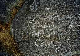
Old Graffiti
|
Excerpts from diaries are on the information building’s walls.
A two-year-old girl was left behind one morning, another wagon
train found her and brought her on! In ways its was lonely travel,
but there were many wagon trains moving out at the same time,
sometimes on parallel courses, sometimes a few miles behind one
another. |
|
The travelers were called EMIGRANTS on the Emigrant Trail, a reminder
that they were leaving the United States for unsettled territories.
There are constant road markers for modern travelers to show you
the trail and its landmarks: Split rock, Devil’s Gap. We then
began the climb to South Pass, the key to conquering the Rockies.
The highway takes incredible upward swings somewhat to the north
of the trail, up through steep ravines with pines and yellow aspens.
South Pass is a wide flat stark brown plain at the top of America,
swept by cold winds. There are distant mountains to the north
and south. We saw patches of snow. Did the early travelers feel
the same thrill at being at the top of America? |
Travelers at
Independence
Rock
|
A beaver dam in a ravine reminded us that the first white men
to live in the Rockies were the French coureur de bois and the
Mountain Men hunting for furs for Europeans and easterners. The
first white economic enterprise in the Rockies was fur trapping.
At first the trappers made yearly forays into the mountains, then
the fur companies began sending out the supplies so the trappers
could stay year-round in the mountains. They would trap in fall
and spring when the pelts were good and then haul the hides to
the annual summer rendezvous site in the mountains for trading
and socializing. The rendezvous sites are well marked throughout
Wyoming.
High and Dry
|
We also saw evidence of another Rockies economic enterprise: mining.
A side road took us to two wonderful settlements - Atlantic City,
an isolated ravine village of small cabins and houses which still
has a mine, and South Pass City, an outdoor museum. |
South Pass City was first a telegraph and stage stop for the trail
in the 1850’s and flourished during the gold days of the late
1860’s when its Carissa mine was producing and it was home to
2000 people. It had seven hotels, saloons, newspapers, a Masonic
lodge, even a pest house for isolating the ill. It is a ghost
town today. 33 buildings remain along the long main street, offices
and houses and hotels are largely furnished with original objects.
It seems as if the people have just stepped out.

Wind River Gorge (Peggy)